A site dedicated to the geology and the geomorphology of the United States
States: ID
MN
MT NC
NY SC WY
Rocks and Minerals
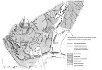
Adirondack Mountains, New York
Lowlands, Carthage-Colton shear zone, Highlands, massif anorthosite.
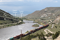
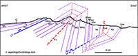
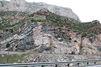
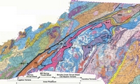
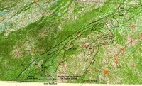
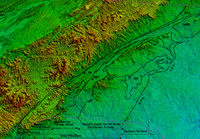
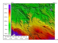
Lombard Thrust, Montana
Lombard thrust (Helena salient), Toston fault, Townsend fault zone, Hossfeldt anticline, kink folds.
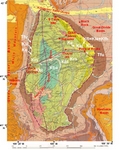
Rock Springs Uplift and Green River Basin, Wyoming
Rock Springs uplift, Green River basin, Leucite Hills, Killpecker Sand Dunes.
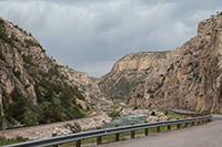
Wind River Canyon, Wyoming
Archean and Paleozoic rocks are exposed in the spectacular Wind River canyon.
The Archean Terranes of Minnesota

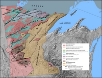
Click on image for full-size display
Morton Gneiss, in the Minnesota River Valley, is an Archean rock (ca. 3.5Ga old):
light-gray tonalite and dark-gray amphibolite inclusions. Quarter gives size.
North Carolina Geologic Maps
Full-resolution Geologic map of North Carolina (NC Geological Survey, 1985)
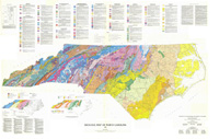
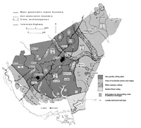
Tectonic maps of the North Carolina Inner Piedmont
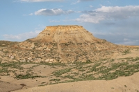
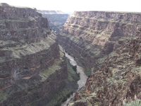
Geology of the Bruneau Canyon, Idaho
Description, maps, photos, origin of one of the most scenic canyons of North America
Clarendon County, South Carolina
Case study of a county of the Middle and Lower Atlantic Coastal Plain : geomorphology, soils, vegetation, agriculture
Currently available: physiographic maps, soil map.
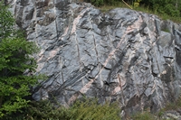
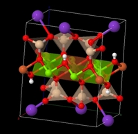
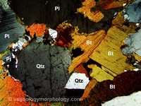
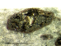
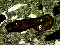
Microphotographs of Rocks and Minerals:
Biotite
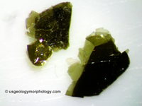
Hornblende
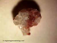
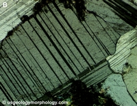
Anorthosite:
Plagioclase (albite twinning, Carlsbad twinning, pericline twinning, Michel Lévy method), hematite, quartz (undulose extinction), sericite