
Rock Springs Uplift and Adjacent Areas (cont.)
3 Killpecker Dune Field
North of the Rock Springs uplift, lies an elongated sand dune field, oriented WNW-ESE, the Killpecker Sand Dunes, named after the south-flowing Killpecker Creek which joins the Bitter Creek in Rock Springs (the slangy name Killpecker was given by pioneers after the nasty effect of its salty water on men). To the west it begins a few miles east of Farson in the Eden Valley (eastern Green River basin), then stretches eastward between the northern end of the Rock Springs uplift (and North Table Mountain) and the hills of the Essex Mountain area (including Steamboat Mountain) into the western Red Desert (Great Divide basin). About 90 km long, this is the largest dune field in the U.S. (fig. 3-1, 3-2). Among these low dunes, some are currently active, mostly in the western part, while the others are dormant (stabilized).
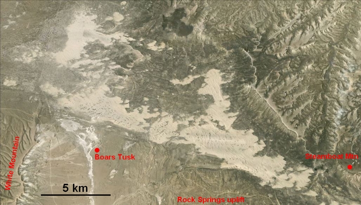
Figure 3-1. Killpecker sand dune field, Wyoming.
Google Earth aerial view to the north from Landsat imagery. Google Earth image © Google. Google and the Google logo are registered trademarks of Google Inc., used with permission.
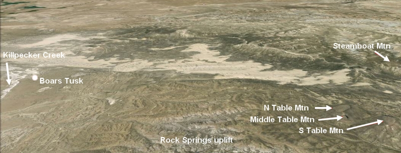
Figure 3-2. Western part of Killpecker sand dune field, Wyoming.
Google Earth 3-D view to the north from Landsat imagery. This image shows that the dune field lies lower than the surrounding areas: Green River basin plateau to the west (upper-left corner), Essex Mountain and Steamboat Mountain to the north, Rocks Springs uplift to the south. Google Earth image © Google. Google and the Google logo are registered trademarks of Google Inc., used with permission.
The area has been studied mostly by Ahlbrandt (1973, 1974a, 1974b) and Mayer and Mahan (2004). These workers recognized several strata, corresponding to different phases of sedimentation, soil formation and erosion. Ahlbrandt, from the mineral analysis of the sand (mostly epidote, hornblende and garnet, in decreasing order), showed it originated from the Laney member of the Green River formation, outcropping west of the dune field, and not from glaciofluvatile deposits, as thought before. The oldest sand strata of the dormant dunes lie on the upper Farson terrace of the Eden valley. This terrace is correlated with the glacial outwashes of the Wind River Mountains, and so is dated at ~20,000 years B.P., i.e. during the interstade between the early and middle stades of Pinedale glaciation (Pinedale I and Pinedale II). That gives a maximum age of 20,000 years for the first deposition of sand. Mayer and Mahan (2004), refining Ahlbrandt's chronology with radiocarbon and luminescence techniques (the latter measure the time elapsed since the burial of the minerals), dated their oldest samples at ~15,000 yr B.P. They confirmed the succession of eolian activity during the cold and dry periods or warm and dry climates, erosion and/or soil formation during wetter periods.
Climate and topography explain the origin of this dune field. The area lies lower than the surrounding plateaus and hills and is badly drained, especially under dry climates. The Quaternary saw the succession of different climates: warm and arid (similar to the current climate or even warmer), cold and dry (glacial ages were dry due to the lack of evaporation) or mild and wet. Dominant western winds deposited the products of the erosion of nearby higher areas of the Green River basin and shaped them into dunes.
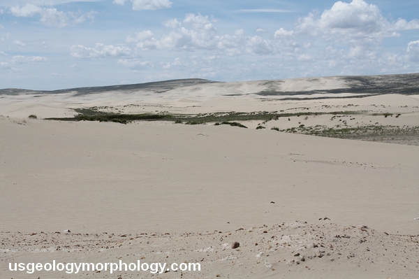
Figure 3-3. Killpecker sand dune field, Wyoming. View to the north.
Lower areas, closer to the water table and therefore wetter, are covered with vegetation.
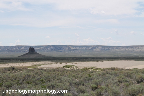
Figure 3-4. Boars Tusk rises above Killpecker dune field. View to the west.
The Killpecker Creek valley lies behind Boars Tusk. The Green River basin plateau (here the White Mountain), with the Laney member at its top, is visible in the background.